News from Caesar's Forum: Towards a ’best practice’ scenario: Urban archaeology in modern cities
What are the best ways to conduct archaeological fieldwork in modern, complex cityscapes such as Rome? In a new publication in the prestigious Journal of Field Archaeology, the team behind The Caesar’s Forum Project describes the best practice strategies used in the first phase of the Danish- Italian excavations on Caesar’s Forum in the heart of Rome. The excavations revealed new details about the so-called Alessandrino Quarter that was destroyed during Mussolini’s regime.
Excavations in living, modern cities such as Rome are often challenging to conduct, since city life is sprawling all around and the complex urban archaeological stratigraphies contain vast amounts of densely accumulated material. In order to investigate the long urban history of Rome, archaeologists therefore need targeted strategies. Centre director professor Rubina Raja at Centre for Urban Network Evolutions (UrbNet, Aarhus University) has worked intensively with urban archaeology for decades. Together with Dr. Jan K. Jacobsen (The Danish Institute in Rome) and Dott. Claudio Parisi Presicce (Sovrintendenza Capitolina ai Beni Culturali, Direzione Musei archeologici e storico-artistici), Raja directs The Caesar’s Forum Project. The three project directors recently published a best-practice method article in Journal of Field Archaeology together with postdoc Dr. Sine G. Saxkjær (UrbNet) and Dott. Giovanni Murro (The Danish Institute in Rome).
High Definition Archaeology in the Alessandrino Quarter
The article highlights the excavation and data sharing strategies implemented by the Caesar’s Forum Project during the first phase of the excavations, which aim to adhere to the FAIR principles regarding Open Access and Open Data in research. During the first phase of the project, the team has excavated – and systematically documented – an area of the so-called Alessandrino Quarter.
This residential area was constructed at the end of the sixteenth century AD and housed about 4000 people up until its demolition under Mussolini in connection with the construction of the parade street Via dell-Impero (today known as Via dei Fori Imperiali) in the centre of Rome. Through the strategic implementation of UrbNet’s high-definition paradigm, where certain groups of material or stratigraphies are investigated in particular detail, it has already now at this early stage in the project been possible for the team to bring forth new crucial knowledge about the importance of the Alessandrino Quarter and in particular about details surrounding the time of its demolition.
Raw data made available
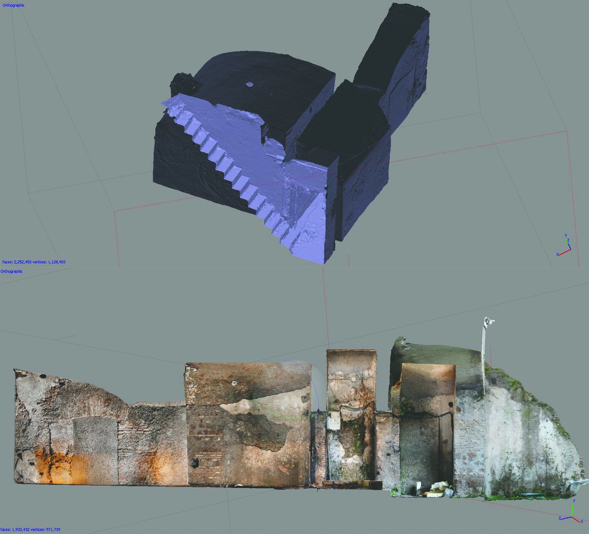
Adhering to the FAIR principles, which aim at improving the accessibility and searchability of data outside the framework of specific projects, the new article addresses the use of Open Access and even more importantly Open Data in the Caesar’s Forum Project. As a supplement to more traditional scientific publications, the raw data from the project is made available to other researchers – and also the general public. Already now, a 3D model of the excavated area at Caesar’s Forum and the associated data is freely available on FigShare. The model is based on photogrammetric images from the excavations and highlight the focus on detailed documentation implemented by the Caesar’s Forum Project in the new excavations. Sharing raw data – both in its raw shape as well as in the condensed form through scientific publications – contributes to a new best practice scenario in urban archaeology in modern cities. This aligns with one of UrbNet’s core agendas to push the boundaries of how archaeology is conducted in urban contexts.
About The Caesar Forum Project
Caesar’s Forum was a monumental public space in the centre of ancient Rome, created as an expansion of Forum Romanum. Gaius Julius Caesar initiated the construction of his forum in 54 BCE and at its inauguration in 46 BCE, it stood as a manifestation of his achievements and his strive for a single-ruler regime. Previous research on the site has established that the archaeological strata of the area covers the period from the 1920s until the Late Bronze Age (13th century BCE). The Caesar’s Forum Project investigates the urban history and development of Rome from the modern period and into the periods before the city’s existence – a timespan of more than 3000 years. The project, which is funded by the Carlsberg Foundation since 2017 and Aarhus University Research Foundation, with a flagship grant since 2019, is a Danish-Italian collaboration between Sovrintendenza Capitolina ai Beni Culturali, The Danish Institute in Rome and Centre for Urban Network Evolutions (UrbNet, Aarhus University).
Reference to full article
Jacobsen, J. K., G. Murro, C. P. Presicce, R. Raja & S. G. Saxkjær (2020). “Practicing Urban Archaeology in a Modern City: The Alessandrino Quarter of Rome”, Journal of Field Archaeology, DOI: 10.1080/00934690.2020.1834255.
Contact
Professor Rubina Raja
Mobile: 27 18 83 90
E-mail: rubina.raja@cas.au.dk
Read more here
Centre for Urban Network Evolutions (UrbNet)
The Danish Institute in Rome
